Our Terms & Conditions | Our Privacy Policy
New Delhi
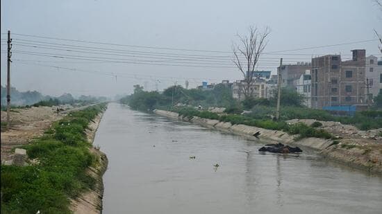
The Munak Canal. (HT Photo)
The Delhi government is commissioning a ₹5.6 crore study, traffic analysis and background planning work for setting up a 20-km elevated corridor connecting the recently inaugurated Urban Extension Road-II (UER-II) to the Outer Ring Road at Inderlok in North Delhi.
At the surface level, recreational spaces, riverfront-like development and non-motorised vehicles lanes will be developed. The project also incorporates fencing of the canal, carrying major chunk of city’s raw water supply, along with redeveloping the lining of the canal, which is leading to a lot of water losses.
A tender in this regard was issued by the public works department (PWD) on August 19.
The work will be done from the Urban Extension Road-II (UER-II) to the Inderlok Metro station, and aims to transform the area into a vibrant, environmentally sustainable space accessible to the public. “The development will be inspired by local art, culture, and heritage, aiming to promote tourism, public engagement, and community interaction,” a PWD official said.
Officials said that the initiative aims to improve urban livability in the area by promoting non-motorised transport and integrating green public spaces. “This will also enhance the ecological value of the canal corridor,” said the official.
The corridor will also feature multiple entry and exit ramps along its length, to ensure local connectivity. The entire project will emphasise the sustainable rejuvenation and beautification of the Munak Canal.
Officials said that the cost also involves the preparation of the detailed project report (DPR) for the road project, which will include cost estimates, structural and landscape designs, and clearances from relevant authorities, besides environmental and social feasibility assessments.
The Munak Canal carries over 1,000 cusecs of water daily to Delhi. In July, HT had reported that Haryana’s irrigation and flood control department stated that the land on which the corridor is proposed, is a “protected forest”, and needs additional clearances for infrastructure work to be carried out.
Images are for reference only.Images and contents gathered automatic from google or 3rd party sources.All rights on the images and contents are with their legal original owners.
Aggregated From –
Comments are closed.