Our Terms & Conditions | Our Privacy Policy
The 1980 eruption cycle made Mount St. Helens one of the most famous and now best-monitored volcanoes in the Cascades. But it is far from the only volcano in the range.
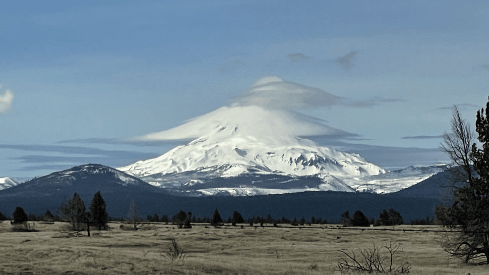
From southern British Columbia to Northern California, the Cascade Range comprises an 800-mile chain of volcanoes.
So, how did this volcanic landscape come to be?
“In the Cascades, broadly, we’re located along a subduction zone,” explained United States Geological Survey (USGS) Research Geologist Emily Johnson. “So that’s where there’s an oceanic plate that’s sinking beneath the North American plate. And that creates this chain of volcanoes because as that oceanic plate sinks, it gets heated up and it starts to release fluids and melt from the plate.”
READ MORE | Past. Present. Future. | Mount St. Helens 45th Anniversary
That magma then works its way up through the Earth’s crust and forms volcanoes.
The Cascades are just one part of the “Ring of Fire,” a series of volcanic arcs and oceanic trenches that surround a large part of the Pacific Ocean.
In the wake of the Mount St. Helens eruption, the USGS opened the Cascades Volcano Observatory in Vancouver, Wash.
“Over time, it began to broaden. We began to expand our studies to other volcanoes in the Cascades,” said Dr. Jon Major, scientist-in-charge at the Cascades Volcano Observatory. “Now that we knew what these volcanoes really were capable of doing, trying to better understand the histories of the volcanoes.”
Of the five USGS volcano observatories, the Cascades Volcano Observatory is now the largest, with close to 80 permanent staff members focused on the Cascades and beyond. Many of them tasked with monitoring volcanoes and volcanic features in Washington, Oregon, and Idaho.
“All of these volcanoes are still considered active geologically. If they had an eruption in the past 10,000 years, that’s an indication that they could wake back up again,” research geologist Alexa Van Eaton told KATU.
According to the USGS, since the beginning of the 18th century, seven Cascade volcanoes have erupted. And over the last 4,000 years, eruptions have occurred at a rate of about two per century — some more explosive than others.
“Mount St. Helens is an outlier in the Cascades in terms of how frequently it erupts explosively. But we have a lot of other potentially hazardous volcanoes in the Cascades,” said Van Eaton. “One little-known volcano, a volcano that doesn’t have such a prominent skyline shape, is Glacier Peak in the north Cascades in Washington. And behind Mount St. Helens, Glacier Peak volcano is the second most-active explosive volcano in the Cascades.”
Glacier Peak last erupted around 1,100 years ago. With no eruption on modern record to observe, these scientists piece together the volcano’s potential from what has been seen at its closest counterpart.
“There’s a lot that we can learn from Mount St. Helens, reading those layers like a book at Mount St. Helens, and then going to a lesser-known volcano like Glacier Peak to understand what the record, what the layers there tell us about the frequency of explosive and hazardous eruptions,” Van Eaton explained.
Right now, all the volcanoes in the Cascades are showing normal levels of background activity. Although normal activity doesn’t necessarily mean no activity.
“In fact, it’s the case that a lot of these volcanoes have earthquakes in their background, and they have swarms in their background activity,” said Weston Thelen, a USGS research seismologist at the Cascades Volcano Observatory.
Each volcano has its own personality, Thelen told KATU.
“Mount Baker has very, very few shallow earthquakes. [It} actually has quite a few deep earthquakes that look like magma is either coming into the system or is cooling under there,” Thelen explained.
“Now, go to Mount Rainier. We have a few earthquakes a week. Most of the earthquakes that are happening at Mount Hood happen within these swarms of activity. Go down south and get to a place like Crater Lake, where there’s very few earthquakes anywhere in the system at Crater Lake. And so, there is a real diversity of activity across the range,” he continued.
What is causing such a range in those behaviors?
“There’s some indication that that might be because of where it is with respect to the regional tectonics and the regional stresses,” Thelen said. “And so in Oregon, we have extension. In Washington, we have compression because of the combination of the subduction zone offshore and, actually, the San Andreas and the Walker Lane pushing northward. That’s generating rotation, and that gives us kind of different stress regimes in Washington and Oregon. So that is probably one of the main factors that’s driving the different behaviors of these volcanoes.”
READ MORE | Newly renovated Mount St. Helens visitor center reopens
It’s not just earthquakes that define these volcanoes’ personalities. They can have unique eruption styles as well. Take Mount Hood, for example.
“There are some cascade volcanoes like Mount Hood, for example, that erupt pretty monotonous or very homogeneous compositions. They don’t change a whole lot,” explained research geologist Emily Johnson.
“St. Helens is a bit unique in having these really diverse eruption styles and magma compositions. And Mount Hood typically erupts more sort of intermediate magmas in between our mafic basaltic and our dacitic compositions. It doesn’t have as many explosive eruptions by far as Mount St. Helens does,” Johnson added.
Johnson said two similarities Mount Hood has with Mount St. Helens are the possibility of lahars, or volcanic mudflows, and for a flank of the volcano collapsing. However, the frequency of eruptions at Mount Hood is much lower.
Tracking and understanding these volcanoes’ personalities helps the scientists understand how each one is responding to the stresses happening in the ground underneath it — gases escaping, magma moving, or faults slipping — and provides clues to how it might react before another eruption.
It also helps them recognize when something more unusual is happening.
“Mount Adams is one of those volcanoes that has been very quiet in its history. And so we typically see one earthquake up there every two to three years,” noted Thelen.
That changed in September 2024, when six earthquakes ranging from magnitude 0.9 to 2.0 were recorded.
“Now, six is not a lot of earthquakes to have in a month at any volcano. But when you go from something that hasn’t had any to that, then it’s something that we felt like we needed to get some more details on. And in the case of Mount Adams, this was sort of an opportunity for us,” Thelen said.
Before this, there was only one permanent monitoring station near Mount Adams. The scientists at the Cascades Volcano Observatory jumped on the opportunity to deploy three additional temporary seismic stations to create a larger monitoring footprint.
“If we can record more earthquakes up there, if we can see what’s going on under there in a little bit more detail, then that’s an opportunity for us to understand more about where magma might be moving, if it’s magmatically related, if it’s fault related, if it’s gas related. This was an opportunity for us to understand more about the volcano itself,” he said.
Through January, a total of 12 earthquakes were recorded at Mount Adams — the strongest a 2.0. That earthquake activity has since subsided, but the monitoring activity has only ramped up.
The Forest Service has granted the USGS permits for four new permanent monitoring stations for Mount Adams. The first two are expected to be set up this summer. But that’s still just a handful compared to the 20-plus stations placed around Mount St. Helens, 30 miles to the west.
Why the disparity?
“There’s several volcanoes in the Cascades that are very high-threat volcanoes,” Thelen explained. “And what that means is that they have an active eruptive history and there’s a population that’s exposed to the hazards from that volcano.”
Volcanoes are ranked through a system called NVEWS — the National Volcano Early Warning System — that evaluates the combination of their eruptive history and their exposure to populations.
“For very high-threat volcanoes like Mount St. Helens, we like to have a network that meets that threat level,” Thelen explained. “Going back to this NVEWS ranking or this combination of volcanic activity and population exposure, when you put those together, Mount Adams is not at the highest threat tier. It’s actually at the second tier down, which is still a high-threat volcano. But that doesn’t quite meet the level that say Mount St. Helens or Mount Hood or Mount Rainier do right nearby there.”
“We’re really sort of concentrating on improving the monitoring and interpreting the data from those really very high threat volcanoes and some high threat volcanoes,” he added.
Thelen noted there are some prominent and recognizable volcanoes that are on an even lower threat tier.
“Mount Jefferson is one example in Oregon, and you know on occasion we can see it from here in the Portland Basin,” he said. “It looks like every other Cascade volcano, but based on what we know about its volcanic history and the lack of population around it isn’t even in the high threat, it’s in the next threat level below that. And so that’s an example of needing to know about both the population exposure, but really critically knowing about the geologic history of the volcano really kind of informs that threat ranking.”
Those earthquakes at Mount Adams also offered another opportunity that could come in handy should another low-threat volcano start to wake up.
“Another side effect of the Adams deployment was that this is an opportunity for us to kind of practice how we deploy instruments. And having not just drills but real opportunities to go out there and put these instruments in and exercise those systems is really good,” said Thelen.
The peaks of Mount Hood, Mount Adams, Mount St. Helens, and Mount Rainier are iconic and easily recognizable. But volcanic features are much closer to many of our backyards than we may realize.
“That’s true for many things, even the smaller volcanoes throughout Portland like Rocky Butte and Mount Tabor. Those are old little volcanoes that are right within city limits,” Emily Johnson said.
Rocky Butte and Mount Tabor were formed as part of the Boring Volcanic Field.
“Named for Boring, Oregon, not because the volcanoes are boring,” Johnson quipped.
READ MORE | An underwater volcano in the PNW is getting ready to blow
It was formed through a process called distributed volcanism.
“So instead of having a central vent that erupts many times and produces a large, long-lived volcano like St. Helens or Hood, you can also have magma that pops up to the surface in little one-off eruptions,” Johnson explained. “And that’s what Mount Tabor, Rocky Butte, and those volcanoes represent.”
The Boring Volcanic Field consists of 80 known volcanic vents. More vents likely exist but were buried by the Missoula floods about 15,000 years ago at the end of the last ice age.
Activity ceased within the Boring Volcanic Field many millennia ago, but others have been active much more recently, geologically speaking.
“And while the Boring Volcanic Field in Portland hasn’t been active in quite some time, I think the most recent eruption was 68,000 years ago. There are other volcanic fields in Oregon that have erupted very recently,” said Johnson. “So, if anyone’s driven McKenzie Pass or Santiam Pass and you cross those lava fields, that is a distributed volcanic field. There are small volume one-off eruptions there, cinder cones and lava flows that erupted very frequently for a couple of thousand years up to about 1,500 years ago. It’s really young, small one-off eruptions.”
Just like their larger-peaked counterparts, if any activity starts within a distributed volcanic field, scientists will see it start to ramp up.
“Just like any of our other volcanoes, magma moving through the crust will produce seismicity or earthquakes,” Johnson noted. “We expect to see deformation, the ground surface moving up. So, we would still see all of those same warning signals. And at that point, we might be able to decide, OK, I think the next volcanic eruption might be in this region over here.”
Slightly to the south of McKenzie Pass, scientists have been keeping an eye on ground uplift just to the west of South Sister Volcano. That uplift started in the mid-1990s and slowly tapered off going into 2020.
Between 1995 and 2020, the area rose 12 inches at its center. Another subtle pulse of uplift started again in the summer of 2020 through August 2021. However, no other signs pointing to an eruption, such as release of volcanic gases or earthquake swarms, were detected.
USGS scientists think it’s happening as either magma or hot fluids and gas build up about four miles below the surface.
Today, the Three Sisters remain at normal background activity levels, and there is no threat of eruption. When volcanic activity does start to ramp up, wherever it might be, one of the key duties of the Cascades Volcano Observatory is getting the word out to the public.
If needed, they’ll start raising the alert level. Green means normal background activity. Yellow or advisory is next. There are signs of elevated unrest.
Then comes orange or watch level. The volcano is showing heightened or escalating unrest, or an eruption is underway but poses limited hazards. Finally, it reaches red, or warning level — a hazardous eruption is imminent, underway, or suspected.
“We’re not going to go from background level to advisory overnight. We’re not going to go from advisory to an eruption. We’re not going to go from background level to an eruption overnight,” said Major. “But as I said in 2004, Mount St. Helens went from background level to an explosion within a week. So, it can progress pretty rapidly.”
Should the alert level of a volcano change, the USGS says multiple agencies would start coming together in case a response is needed.
“As soon as we were to start changing the alert level status of a volcano that triggers a lot of interaction with a lot of communities, a lot of emergency responders, a lot of other federal agencies,” Major explained. “So, it would be pretty immediate.”
Part of their preparedness includes creating hazard assessments and hazard maps.
“So, we’re really taking the lessons from 1980, putting that forward into hazard assessments, and then being able to translate that work to the public and the emergency managers. OK, here are the hazards this volcano is capable of producing. Here are our best estimates of the areas that are at risk from different volcanic processes. And as we do more research and we learn more, we’re able to refine that,” Major said.
In the meantime, the scientists at the Cascades Volcano Observatory will keep watching, studying, and learning. And they say they will be ready the next time one of our volcanoes comes to life.
“We are doing a good job of monitoring these volcanoes, and we will see changes, and we know what the background is,” said Emily Johnson. “We know what normal is for Hood. We know what normal is for St. Helens, and we’ll see something out of the ordinary.”
If you’d like to keep up with what’s going on with the Cascade Volcanoes, the USGS has a free volcano notification service you can sign up for. They’ll send you updates via email on what’s going on with the Volcanoes in the Northwest, and if you like other volcanoes they monitor across the U.S.
Images are for reference only.Images and contents gathered automatic from google or 3rd party sources.All rights on the images and contents are with their legal original owners.
Aggregated From –
Comments are closed.