Our Terms & Conditions | Our Privacy Policy
Cascadia mega-tsunami threat Pacific Northwest: What is a mega-tsunami? Scientists sound alarm for US Pacific coast — could it happen and how far inland would it reach?
The Pacific Northwest, celebrated for its forests, coffee culture, and dramatic coastlines, is sitting on a geological time bomb. Beneath the calm surface of the Pacific, the Cascadia Subduction Zone (CSZ) stretches for nearly 600 miles from Northern California to Vancouver Island. Scientists warn that this quiet fault could one day unleash a mega-earthquake and tsunami so massive it would rewrite the region’s history in minutes.
It’s not alarmist speculation. It’s science, and the stakes are enormous.
What makes the Cascadia Subduction Zone so dangerous?
The CSZ is where the Juan de Fuca Plate slowly grinds under the North American Plate—a process called subduction. While the movement is imperceptible day-to-day, the fault is silently storing up stress. Eventually, that energy will release.
Unlike smaller quakes, subduction events are deep, powerful, and sprawling. When Cascadia breaks, experts project a quake over magnitude 8.0—possibly approaching 9.0. That’s not just ground shaking; it’s continent-shifting. And when the ocean floor suddenly lurches, walls of water will rise.
The last time Cascadia ruptured was on January 26, 1700. We know this not just from Native oral traditions and drowned coastal forests, but from written records in Japan, where an “orphan tsunami” struck without warning. Geologists studying sediments estimate these quakes recur every 400–600 years. By that math, Cascadia’s clock is uncomfortably close to striking again.
Live Events
How big could a Cascadia tsunami really be?
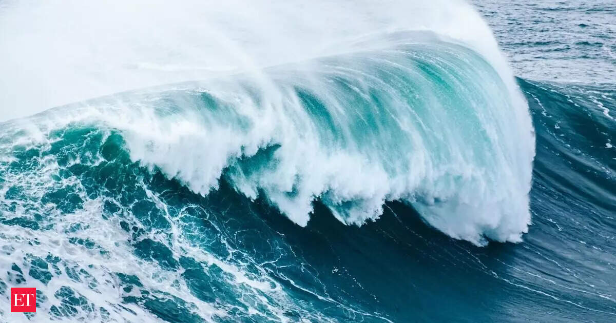
Forget the Hollywood idea of a single towering wave. A Cascadia tsunami would be a series of fast-moving, battering waves. Models suggest the largest could crest 500–1,000 feet in extreme cases, dwarfing skyscrapers and flattening towns. Compounding the danger, parts of the Pacific Northwest coastline could sink by up to 6.5 feet instantly when the fault slips. Imagine entire neighborhoods suddenly dipping below sea level just as the ocean races inland at 500 mph. That’s why scientists say evacuation time could be measured in minutes, not hours. Bays and inlets—from Grays Harbor in Washington to Coos Bay in Oregon—would funnel water into destructive surges. Meanwhile, flat deltas like the Columbia River basin could be inundated miles inland.
What would life look like after such a disaster?
The devastation wouldn’t end when the waves recede. Power grids, bridges, and hospitals would collapse under the strain. Ports that drive billions in trade—like Seattle, Tacoma, and Portland—could be out of service for months. The U.S. economy, dependent on West Coast shipping, would feel ripple effects nationwide.
Insurance analysts already estimate damages in the tens of billions for a full rupture scenario. Some researchers compare the recovery timeline not to Hurricane Katrina, but to the 2011 Tōhoku earthquake and tsunami in Japan—a disaster that still scars the nation’s landscape and economy more than a decade later.
The environmental toll would be equally staggering. Farmland would be poisoned with saltwater, river ecosystems disrupted, and coastal habitats destroyed. “The tsunami isn’t just a wave—it’s an ecological reset button,” notes Dr. Chris Goldfinger, a leading Oregon State University seismologist.
Can we prepare for a Cascadia mega-tsunami?
Preparation won’t stop the quake, but it can save lives. Scientists stress three priorities:
- Early-warning systems – Undersea sensors connected to sirens and cell alerts can give people vital seconds to minutes to flee. Japan’s system saved thousands in 2011; the U.S. is still building its Pacific version.
- Stronger infrastructure – Retrofitting schools, hospitals, and bridges to resist both shaking and flooding. Japan and Chile offer lessons here—regions that have turned past tragedies into engineering revolutions.
- Community drills and education – The most effective survival tool is knowing what to do. Residents must recognize the signs: strong ground shaking, receding ocean water, or unusual tides. And then? Move uphill, without hesitation.
In towns like Seaside, Oregon, officials have already built vertical evacuation towers—essentially tsunami-proof buildings designed to save lives when roads and bridges are cut off. But most of the Pacific Northwest still lags behind.
Should residents be worried right now?
The honest answer: not worried every day, but prepared every day. Statistically, the chance of a Cascadia rupture in any given year is small—about 1 in 300 for a full-margin quake. But when the odds are multiplied over decades, and the consequences are civilization-altering, complacency is not an option.
“The earthquake is inevitable. The tsunami is inevitable. The only question is when,” says FEMA’s Region X planner Kenneth Murphy. “Everything west of Interstate 5 will be toast.”
FAQs:
Q1: What is the Cascadia mega-tsunami risk?
It’s the threat of a magnitude 8–9 earthquake along the Cascadia Subduction Zone, capable of producing tsunamis hundreds of feet high and devastating Pacific Northwest coastlines within minutes.
Q2: How can residents prepare?
Have an emergency kit, know your evacuation route, take part in local tsunami drills, and pay attention to early-warning systems. When the ground shakes, don’t wait—head to higher ground immediately.
Images are for reference only.Images and contents gathered automatic from google or 3rd party sources.All rights on the images and contents are with their legal original owners.
Aggregated From –
Comments are closed.