



Original Coverage & Source Attribution: fredpickhardt.substack.com
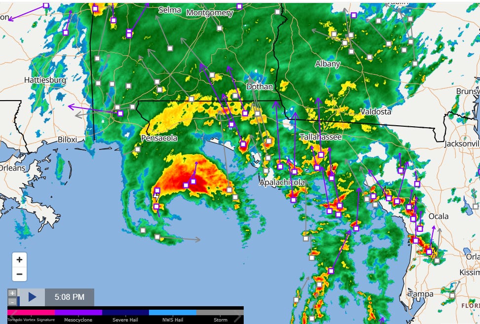
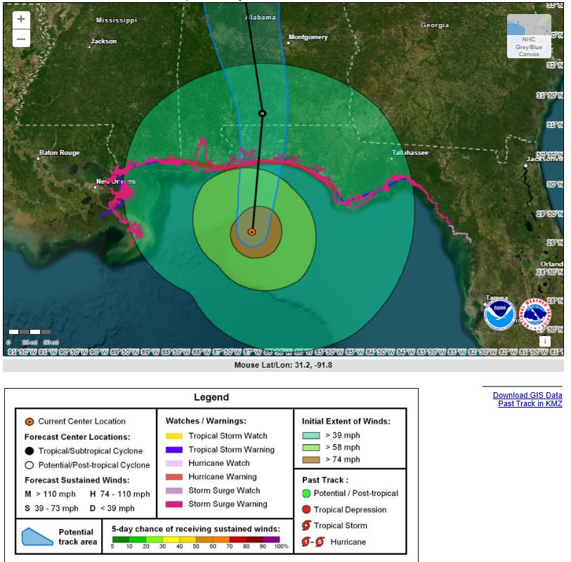
Hurricane Isaias remains a Category 3 storm with 115 mph (100 kt) maximum sustained winds and is projected to make landfall near the Pensacola, Florida area this evening.
Located at 29.2N, 87.0W, moving north at 17 mph (15 kt). High wind shear is causing the storm to become asymmetric with the most intense weather concentrated in the northern eyewall. It will be a highly gusty storm, carrying strong wind threats far inland due to its fast forward speed.
After landfall in the western Florida Panhandle tonight, the center will move through Alabama on Saturday and track northeast across Tennessee and the central Appalachians on Sunday before dissipating.
-
Storm Surge: A life-threatening storm surge is expected from the mouth of the Mississippi River to Suwannee, Florida.
-
Winds: Hurricane-force winds are imminent for the Florida Panhandle, southern Alabama, and southern Mississippi. High-profile wind gusts will extend well inland into Georgia, the southern Appalachians, and Tennessee, threatening widespread power outages and falling trees.
-
Flooding & Landslides: Heavy rainfall will bring significant flash, urban, and river flooding across the Southeast through the weekend, alongside potential landslides in the Southern Appalachians.
-
Tornadoes: Tornado risks persist through tonight, primarily east of the storm’s center across the Florida Panhandle and southern Georgia, spreading north-northeast into Saturday.
Forensic Marine Weather Expert
NOAA National Hurricane Center
NOAA US Coastal Waters Forecasts