



Original Coverage & Source Attribution: fredpickhardt.substack.com
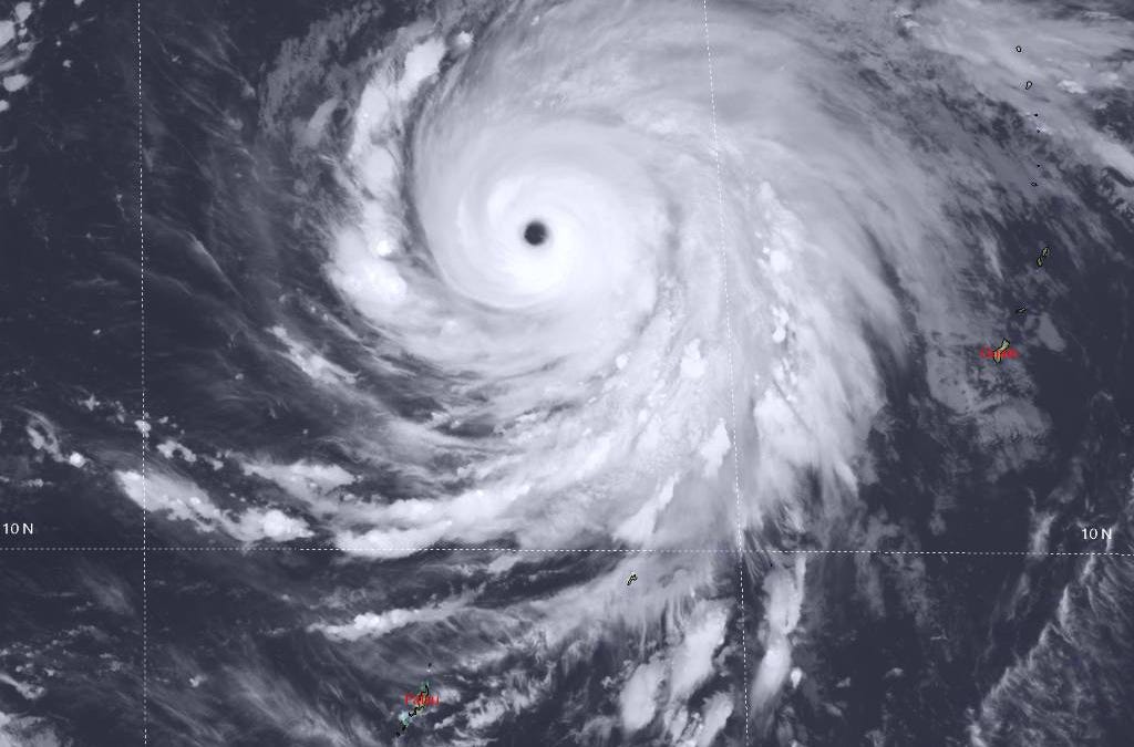
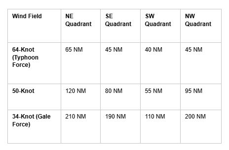
Super Typhoon 29W (Champi) now packing max winds to 135 knots with wave heights to 16 meters over the western North Pacific with hurricane-force winds extending out up to 65 nm.
-
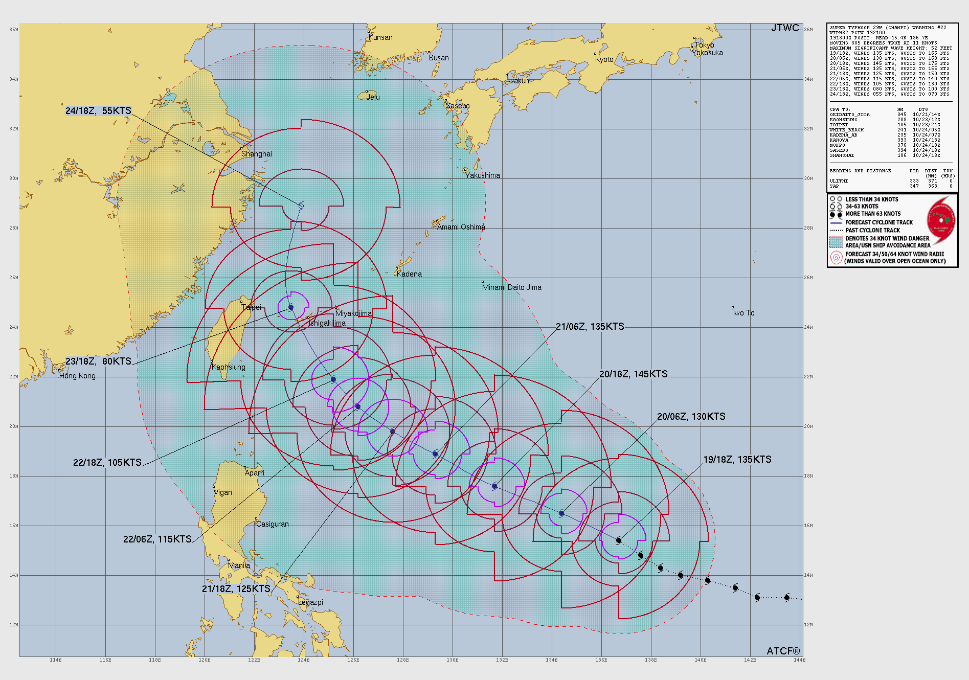
Location: 15.4°N, 136.7°E (Approx. 766 NM South-Southwest of Chichi Jima)
-
Movement: Northwest (305 degrees) at 11 knots
Champi currently has an 18-nautical-mile symmetrical eye and is undergoing an Eyewall Replacement Cycle (ERC). While this may cause a brief period of weakening over the next 12 hours, the broader environment remains highly favorable. Low vertical wind shear, warm 29–30°C sea surface temperatures, and robust outflow will allow the system to recover. A secondary intensity peak of 145 knots is forecast within the next 24 hours as the inner eyewall contracts.
Champi will maintain its northwestward trajectory for the next 60 hours, then weakening is anticipated due to ocean upwelling. Champi is expected to cross the Ryukyu Islands in about 96 hours.
Some models show Champi continuing on track toward Taiwan and China, while others favor a recurve scenario turning northeastward toward Japan.
Forensic Marine Weather Expert