



Original Coverage & Source Attribution: theeyewall.substack.com
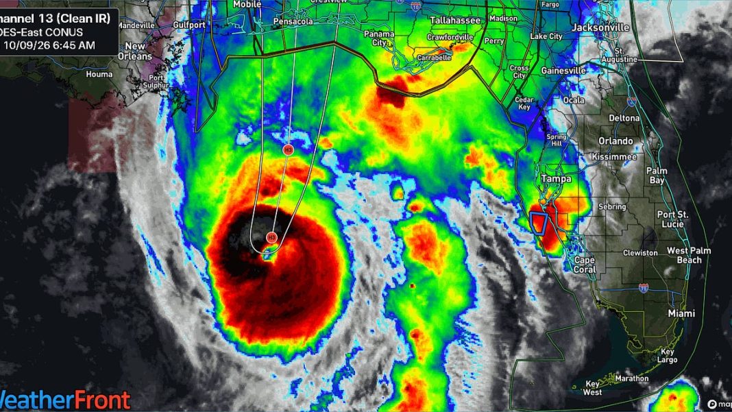
In brief: A morning update on Hurricane Isaias, now the season’s first major hurricane. The exact intensity remains a little challenging for landfall, but at this point, the western Florida Panhandle should be preparing for a major hurricane to make landfall tonight.
I just want to get a quick morning update out on Hurricane Isaias.
Over the last 12 hours or so, Isaias has steadily strengthening, with its core incubated from the disruptive wind shear that surrounds it. What this has led to is an environment over exceptionally warm water where the storm can thrive. Certainly, it’s not without flaws, but this is a bonafide major hurricane over the Gulf.
The track forecast is basically unchanged, with a western Florida Panhandle focus for a probable landfall tonight.
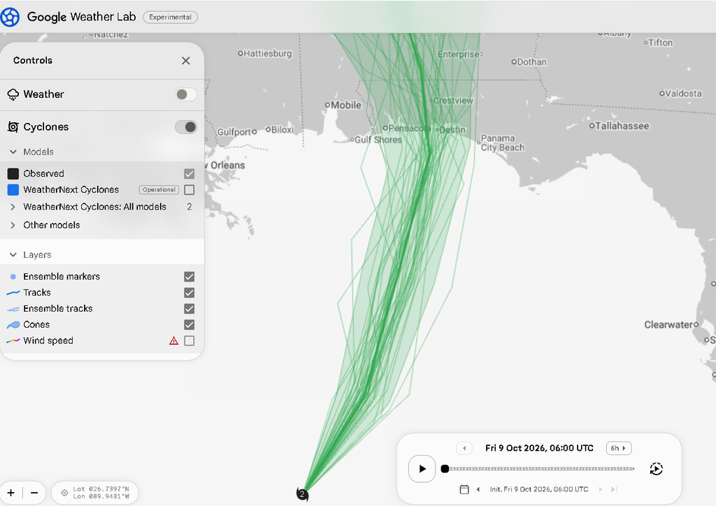
In terms of what it comes in as? Well, we’ve been warning you all along that this storm is likely to weaken toward landfall, but the margin of error was a little too close for comfort. That remains the case this morning. Isaias is probably going to get another 6 to 8 hours of time to strengthen before it can’t keep back the shear any further. By that time, we expect Isaias to be 100 to 150 miles south of the Florida Panhandle, meaning it will have only that long under a hostile shear environment to weaken.
Whether it actually happens or not, folks from Gulf Shores through about Panama City should be preparing for a major hurricane to make landfall by midnight.
The only other notable changes have been that the surge forecast has been bumped up some, and the tornado risk tomorrow expanded a bit into South Carolina.
The surge is now a bit higher near and east of the landfall point, and it is correspondingly a bit lower in Mobile Bay and on the Alabama coast.
In terms of the tornado risk tomorrow, a yellow slight risk (2/5) extends from the Panhandle into southeast Georgia and South Carolina.
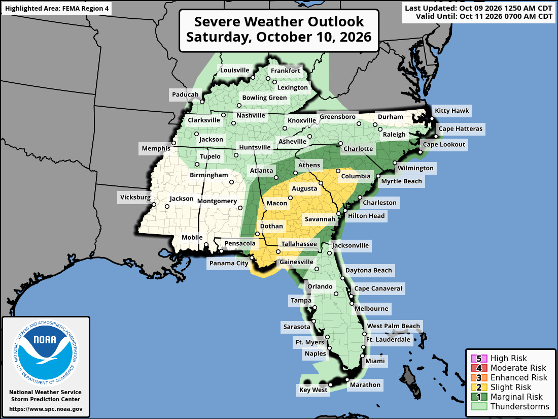
The SPC did consider adding in a more substantial tornado intensity risk contour but held off for now. So at this point, while this is the risk, there is a slight chance we could see this get nudged up some before tomorrow. Either way, scattered instances of tornado warnings seem likely tomorrow in the yellow or dark green shaded areas above.
That’s all for now. We’ll be back with another update this afternoon.