


Original Coverage & Source Attribution: www.vietnam.vn
Historically, the wave of artificial intelligence development has largely focused on scaling parameters, text volumes, images, or media formats. The spatial dimension on a global scale remains largely an unexplored wilderness.
Now, a groundbreaking study from the scientific team of Professor Shi Zhenwei and Professor Zou Zhengxia of Beijing University of Aeronautics and Astronautics has officially broken that barrier.
The research, titled MetaEarth3D, has just been published on the arXiv academic archive and officially accepted by the prestigious National Science Review, marking the first time artificial intelligence has been able to create complete world-scale three-dimensional scenes from remote sensing data alone.
A new study by professors Shi Zhenwei and Zou Zhengxia (Beijing University of Aeronautics and Astronautics) introduces MetaEarth3D – a foundational model for the creation of three-dimensional, Earth-scale spatial expansion, published on arXiv and officially adopted by National Science Review.
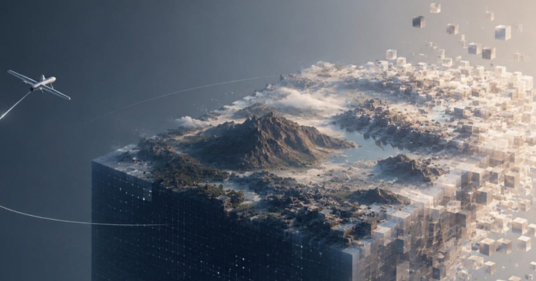
The extraordinary aspect of the model lies in the fact that the operator only needs to input a short descriptive sentence or provide a satellite image. Immediately, the system can create an entire infinitely expansive and seamless three-dimensional world, ranging from massive natural landscapes like mountains, deserts, and coastlines to medium-sized cities and sophisticated urban blocks.
This artificial environment not only creates a visual representation but also incorporates original spatial parameters such as actual physical elevation and distance.
When this simulated data source was used in experimental training of artificial intelligence systems controlling low-altitude drones, the devices’ spatial understanding capabilities recorded an impressive average growth of 22.85%.
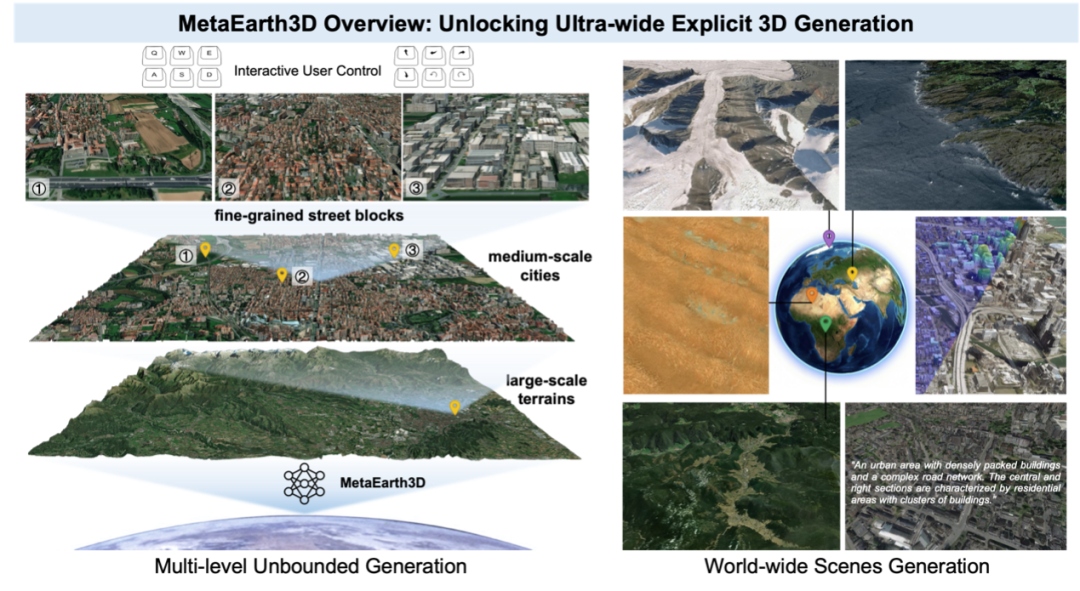
From just a descriptive text sentence or a satellite image, the model can generate endless, continuous, and consistent three-dimensional scenes ranging from large-scale terrain and medium-sized urban areas to individual city blocks, complete with original measurement labels (height, distance), increasing the spatial understanding capabilities of aerospace artificial intelligence by an average of 22.85%.
Many people might confuse this technology with the familiar Google Earth platform, but the authors assert that the two systems follow two completely opposite technical paths.
Essentially, Google Earth is a massive data repository where the real world is collected beforehand through aerial photography and remote sensing satellites, then reconstructed and stored as a triangular grid or point cloud.
When someone views the content, the system simply extracts the available data to display, requiring an extremely complex preparation process and enormous costs.
In contrast, MetaEarth3D operates entirely on artificial neural networks. It doesn’t replicate existing worlds but creates entirely new ones, a space that has never existed before but is absolutely accurate according to statistical laws regarding geomorphology, elevation, and visual distribution of the Earth.
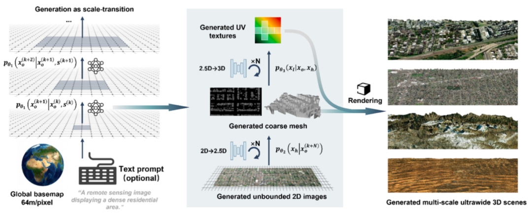
Google Earth is a pre-built database created through expensive field data collection and reconstruction; whereas MetaEarth3D is a purely neural network model that automatically generates a three-dimensional world that has never existed before, yet fully adheres to the statistical laws of the real world.
To achieve this feat, the research team had to solve the challenging problem of the scarcity of real-world three-dimensional data sources.
Instead of the costly process of collecting expensive spatial scanning datasets, the team used a method of converting three-dimensional scenes into surveillance signals from two-dimensional images, leveraging a global database of approximately 10 million images combined with an asymptotically distributed probability shift framework.
Despite having 4.6 billion parameters, MetaEarth3D optimizes computing power remarkably: with just a common NVIDIA RTX 3090 graphics card, the system can create an entire urban area of up to 17 square kilometers in approximately 2 hours.
This model outputs a clear three-dimensional format, allowing direct compatibility with graphics software such as UE or Unity without the long-distance discrepancies often seen with conventional video generation models.
This spatial manipulation capability opens the door to invaluable applications for drone systems, autonomous vehicles, and intelligent robots.
Most notably, the ability to generate “black swan” scenarios—situations extremely rare in real life but with devastating consequences—allows the automated machines to practice and prepare thoroughly for any critical event.
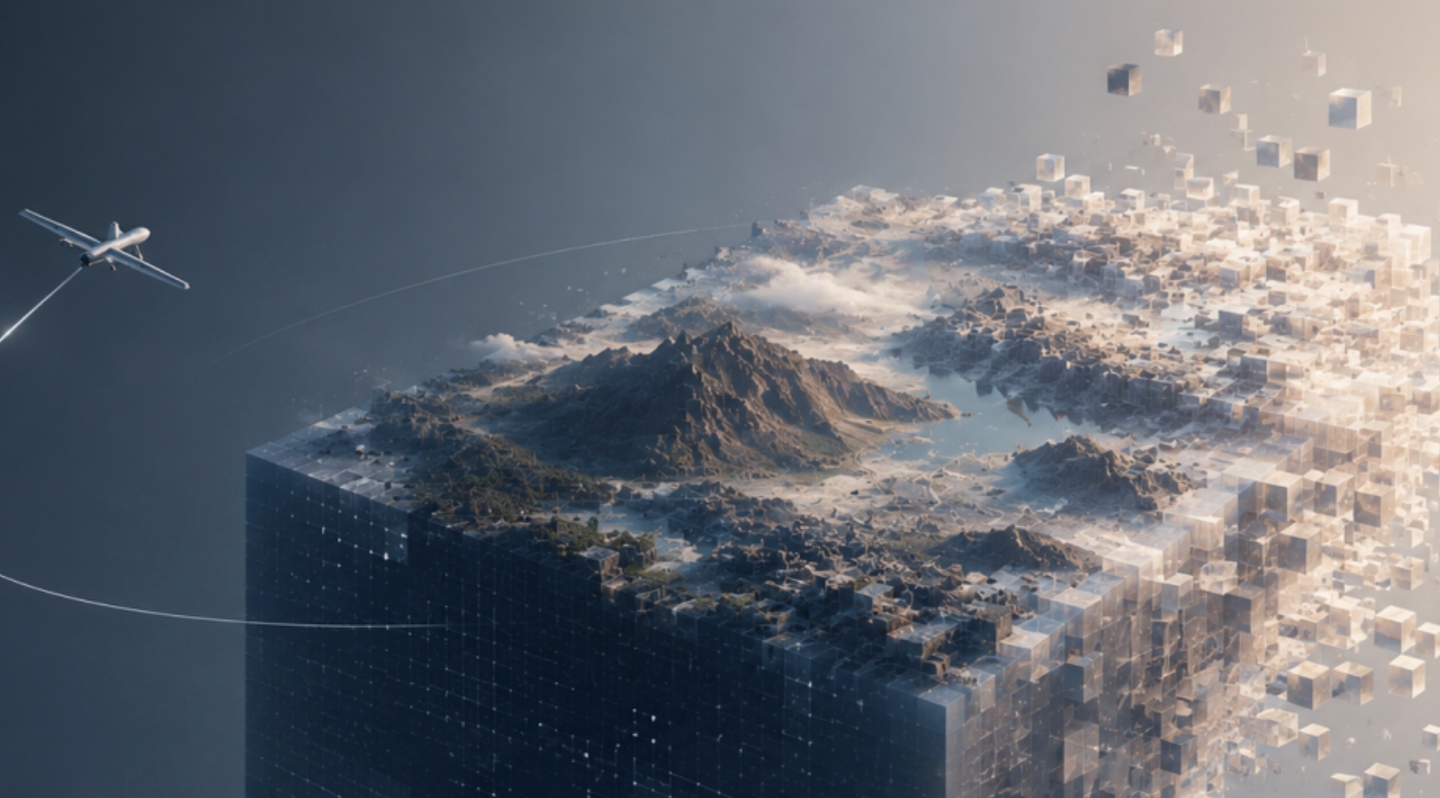
The model has 4.6 billion parameters, trains from 10 million global images, but uses very light reasoning; an NVIDIA RTX 3090 graphics card is all that’s needed to create a 17-square-kilometer urban model in 2 hours; overcoming the expensive three-dimensional data bottleneck by using two-dimensional image monitoring signals and a progression-distributed probability shift frames.
Despite remaining hurdles such as the fact that the current imagery only captures a fixed point in time and doesn’t reflect changes over time and seasons, and the system only simulates the visible light spectrum without integrating lidar or thermal infrared, MetaEarth3D has clearly set a historical milestone.
Artificial intelligence is no longer just a tool for creating conventional content; it is now evolving into a fundamental data infrastructure, opening up an endless digital universe to serve the evolution of the future technological world.